Those are regional extracts and tile archives of the GPX Planet.
You can process those with perl scripts, or make your own tools.

Visualisation of all GPS tracks is here.

Made by Ilya Zverev. Points are licensed CC-BY-SA by OpenStreetMap.
| archive | Archived tiles and bitiles | ||
| extracts | GPS points extracts | ||
| Special TMS for Poland.html | 403 | 16-04-2013 | |
| gps-extracts-polygons.tar.xz | 123 K | 22-04-2013 | Filtering polygons used to make extracts (mostly from GeoFabrik) |
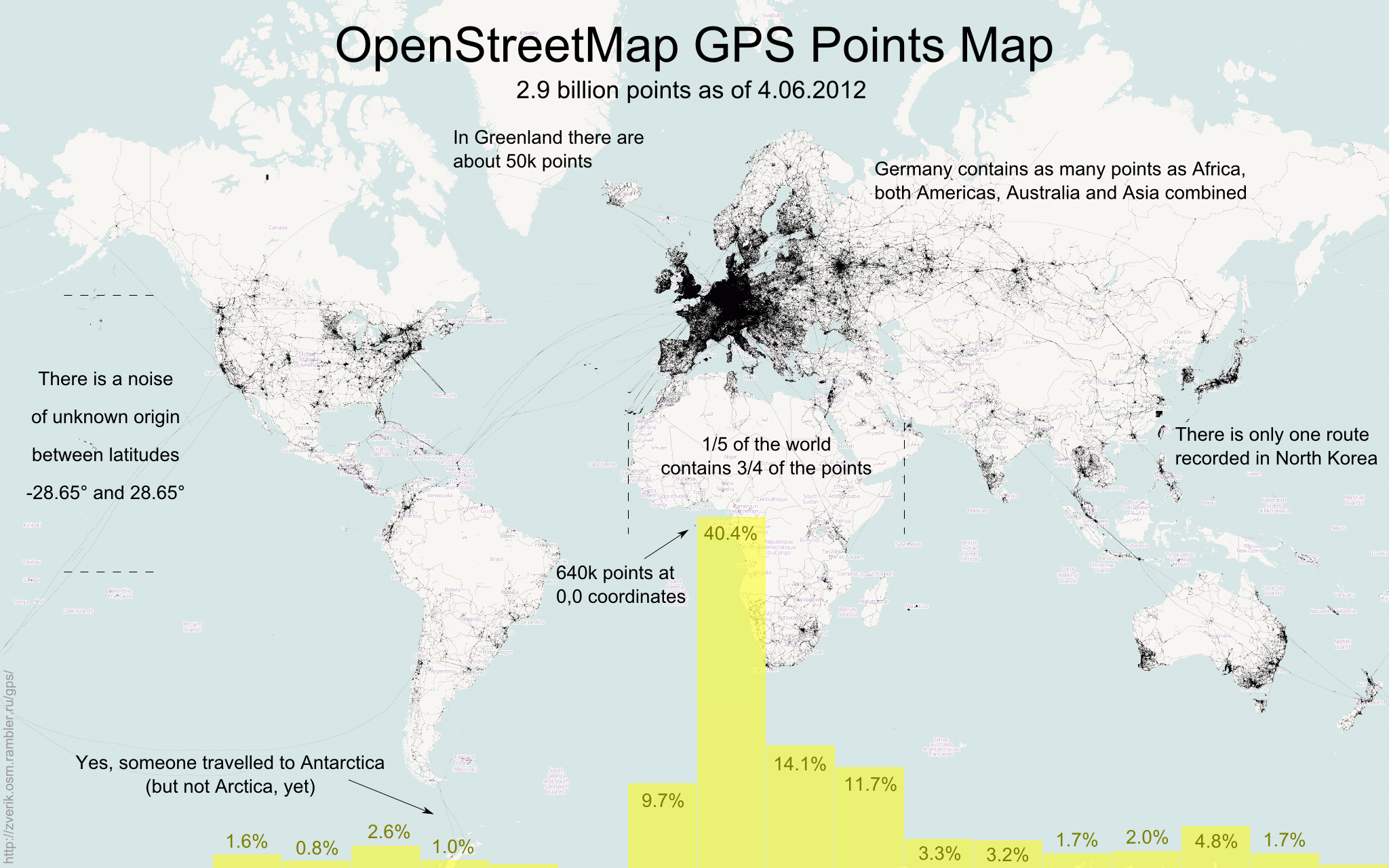
| world-gps-points-120604-2048.png | 1597 K | 10-09-2012 | A large poster with statistics and interesting facts |
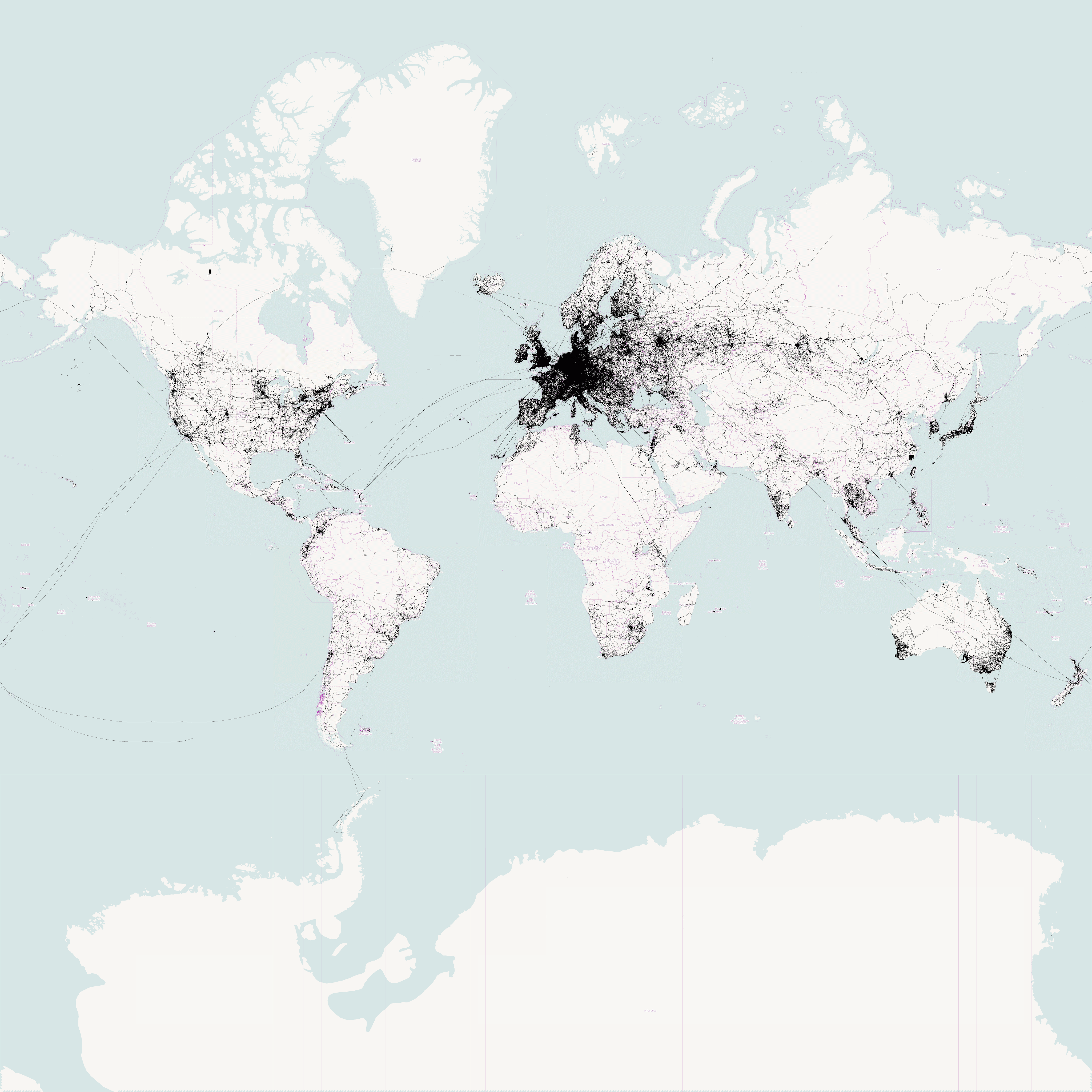
| world-gps-points-120604-4096-source.png | 3874 K | 07-09-2012 | All GPS points at zoom 4 (generated from tiles of zoom 5). |
Created with recursive_index.pl on 23-04-2013.